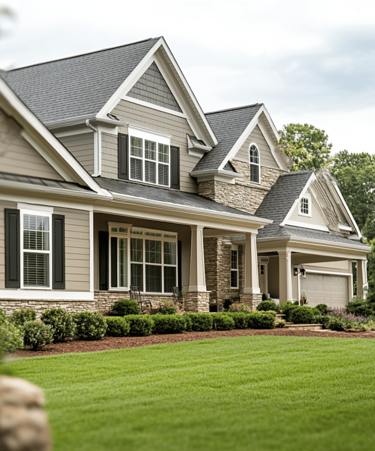
Is your perfect Beverly Shores retreat perched high with sweeping lake views, or planted right on the sand with toes-in-the-water access? If you are eyeing Lake Michigan lots for a second home, you are not alone in asking this. Each setting feels different day to day and carries its own rules, risks, and upkeep. In this guide, you will learn how bluff and beachfront lots compare in Beverly Shores, what regulations and surveys matter, and which lifestyle fits you best. Let’s dive in.
Bluff vs beachfront: clear definitions
Bluff lot: The primary building site sits on elevated ground above the beach or waterline. Beach access is often indirect and may involve stairs, a switchback path, a private easement, or a public access point.
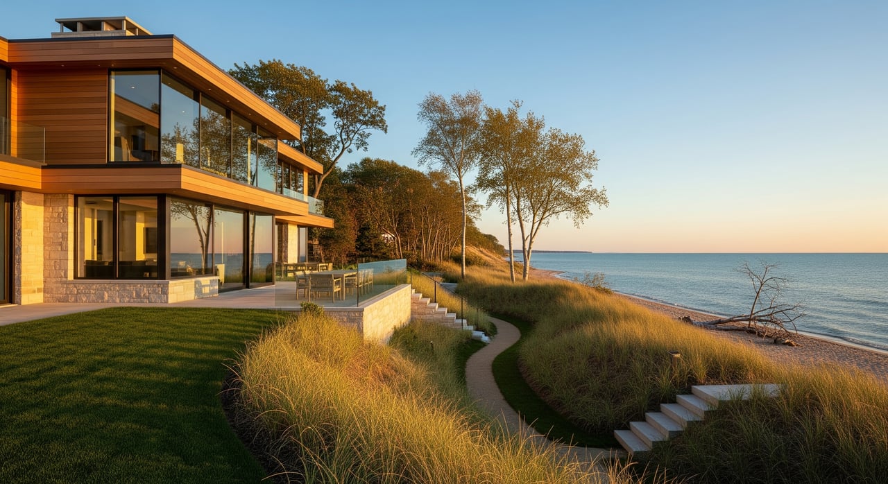
Beachfront lot: The building site is at or near lake level with direct, usually level access to the sand and water. A single parcel can sometimes blend both traits, such as a bluff-top home with a lower beach terrace.
In Beverly Shores, you will encounter both types. The shoreline is dynamic, with dunes, bluffs, and flat beach sections shaped by seasonal storms and changing lake levels.
How access really feels
- Bluff lots: Expect a deliberate trip down and back up for daily beach time. Many owners rely on private stairs, winding paths, or public access points. Moving gear, handling maintenance, or ensuring winter access can be harder on steep routes.
- Beachfront lots: You usually step right onto the sand for swimming or launching small watercraft. Seasonal sand movement and any public easements can influence where you can walk or set up for the day.
The takeaway: beachfront wins for doorstep convenience. Bluffs ask for more planning around movement, guests, and services.
Views, privacy, and neighbors
- Bluff lots: Elevated positions create long sightlines and can feel more private. Vegetation and slope often screen neighboring homes and paths.
- Beachfront lots: Horizon views are direct and dramatic, but the lower elevation narrows the angle. Neighbors and public beach users may be more visible.
With either option, views can change over time due to vegetation, new projects, or local rules on tree removal and setbacks. Verify the current view corridor and what you can and cannot alter.
Erosion and shoreline dynamics
Lake Michigan is not static. Water levels move through seasonal and multi-year cycles, and storms can reshape dunes and beaches in a single weekend.
- Bluff risk profile: Bluffs can retreat through erosion, slumping, and mass wasting, especially during heavy rain or high-water periods. Stabilization often focuses on drainage control, vegetation, and sometimes structural measures.
- Beachfront risk profile: Beach-level sites face wave attack, overwash, and dune loss in severe storms. Beach profiles shift seasonally, which can change where the water meets the shore.
Hard shoreline structures are costly and frequently regulated or discouraged. Soft approaches such as vegetation, dune restoration, and sand fencing are commonly recommended where allowed.
Maintenance and costs you should expect
- Bluff maintenance: Ongoing erosion monitoring, slope stabilization, landscape management to prevent undercutting, and potential structural repairs if the bluff edge migrates toward improvements.
- Beachfront maintenance: Dune restoration, sand fencing, seasonal debris cleanup, sand regrading, and storm-related repairs.
- For both: Insurance, inspections, and possible special assessments if an HOA or coastal management program applies.
Plan for periodic site checkups after major storms and at the change of seasons.
Rules, permits, and boundaries in Porter County
Several layers of oversight can apply in Beverly Shores. The exact mix depends on your site and any work you plan to do.
- Property lines and OHWM: On the Great Lakes, land seaward of the ordinary high-water mark may be part of the public trust. Ownership typically extends to the OHWM, not into the lakebed. Ask for a recent boundary survey that shows the OHWM and consult a local real estate attorney to interpret rights and limits.
- Zoning and setbacks: Porter County Planning and Building sets local rules on setbacks, height, and lot coverage. Bluff-edge setbacks are common and can determine where a house or deck is legal.
- Permits: Stairways, paths, vegetation removal, dune or bluff stabilization, and any shoreline structure can trigger permits. Overlapping jurisdictions can include the Indiana Department of Natural Resources, the U.S. Army Corps of Engineers, and county authorities.
- Flood zones and insurance: Beachfront parcels are often mapped in FEMA flood zones such as A, AE, or VE. The Base Flood Elevation affects how high you must build and what your flood premiums may be.
- Protected lands: Portions of Beverly Shores sit next to Indiana Dunes National Park or other conserved parcels. Conservation easements, park boundaries, and municipal restrictions can influence how and where you build and access the beach.
Ask the seller for past permits and records of shoreline work. Confirm whether any easements, restrictions, or encroachments affect your plans.
Lifestyle fit: which lot suits you
Choose beachfront if you:
- Value immediate, level access for daily swims and sandy mornings.
- Are comfortable with more frequent maintenance and storm response.
- Accept that flood mapping and insurance requirements may be more stringent.
Choose a bluff if you:
- Prioritize panoramic views and a quieter perch above beach traffic.
- Prefer greater separation from high water and passing foot traffic.
- Are prepared to manage drainage, vegetation, and slope stability over time.
Both options can deliver a classic Beverly Shores experience. Your comfort with access, risk, and upkeep is the deciding factor.
Due diligence checklist for Beverly Shores buyers
Request these items before or during showings:
- A boundary survey showing the OHWM and current elevations.
- Deed and title report, including easements, public access rights, and any conservation restrictions.
- A recent site or topographic survey with slope angles and distance to the bluff edge or waterline.
- FEMA Flood Zone designation and Base Flood Elevation for the lot.
- Records of past shoreline or stabilization work, permits, and maintenance history.
- Any history of insurance claims for flood, storm, or erosion-related damage.
- A soil or geotechnical report for bluff lots or planned construction.
- Information on bluff retreat rates or documented erosion incidents nearby.
- Applicable zoning, setbacks, and any coastal, bluffline, or dune protection overlays.
- Clear explanation of beach access: private easement, deeded access, public access, or none.
- Utility status for water, sewer or septic, electricity, and any limits due to topography.
- HOA rules or community obligations for beach access or maintenance, if applicable.
- Tree removal or vegetation protections that affect view management.
- Any conservation boundaries or proximity to Indiana Dunes National Park.
- Availability, costs, and permitting requirements for stabilization options.
- Emergency services access and winter maintenance for private paths or stairs.
- Neighbor accounts of storm impacts, water-level shifts, and ongoing maintenance.
- Expected private versus public use of adjacent beach areas.
On-site checks during a tour
- Walk the full access route to the beach and note steepness and condition.
- Look for signs of erosion, slumping, exposed roots, or undermined vegetation.
- Identify where storm debris collects to gauge wave reach.
- Observe neighboring parcels for stabilization measures or recent sand loss.
- Confirm utilities and realistic parking for guests.
Financing and insurance realities
Lenders and insurers pay close attention to flood risk, slope stability, and nearby protected lands. Some lenders may ask for engineering or geotechnical reports, especially for bluff sites or major projects. After large storm events, underwriting can tighten and premiums can shift. Specialized coastal insurance providers may be necessary for certain parcels.
If a site falls within a mapped flood zone, budget for flood insurance and any elevation or building requirements tied to the Base Flood Elevation. For bluff locations, be ready to document slope conditions and drainage controls.
Making a confident move in Beverly Shores
The decision between bluff and beachfront comes down to everyday lifestyle and long-term risk management. Beachfront delivers effortless access and a lively relationship with the lake. Bluff sites trade immediate sand for sweeping views and a quieter setting. Either way, careful due diligence on surveys, setbacks, permits, and maintenance plans protects your investment and your time at the lake.
If you want a clear, step-by-step process tailored to your goals, connect with Rob Gow & Chris Pfauser for a private consult. We help you weigh access, risk, and return so your Beverly Shores purchase feels as good in year five as it does on day one.
FAQs
What is the practical difference between bluff and beachfront lots?
- Bluff lots sit above the beach with indirect access, while beachfront lots lie at or near lake level with direct access; views, privacy, and maintenance needs differ accordingly.
How do Lake Michigan water levels affect Beverly Shores properties?
- Seasonal and multi-year water-level swings can accelerate bluff retreat or increase wave action on beachfronts, changing erosion risk and usable beach area.
Why is the OHWM important when buying a lakefront lot?
- On the Great Lakes, ownership often extends only to the ordinary high-water mark, which influences property rights, access, and where you can build or maintain structures.
Which agencies oversee shoreline work in Beverly Shores?
- Expect involvement from Porter County Planning and Building, the Indiana Department of Natural Resources, the U.S. Army Corps of Engineers, and possibly FEMA and the National Park Service.
Are beachfront lots always in a FEMA flood zone?
- Many beachfront parcels are mapped in zones like A, AE, or VE, but you should verify the property’s exact FEMA designation and Base Flood Elevation before you buy.
What maintenance should I budget for on a bluff site?
- Plan for drainage improvements, vegetation management, erosion monitoring, and potential slope stabilization if the bluff edge migrates toward improvements.